Recognizing the clouds is very important for paragliding pilots
Distinguishing clouds is a difficult task because of the vast number of different observable cloud formations. This is why we're going to introduce you to the main clouds in each major family.
Being able to recognize the clouds in the sky is very important for paragliding pilots for anticipating the way the weather might evolve during the flight.
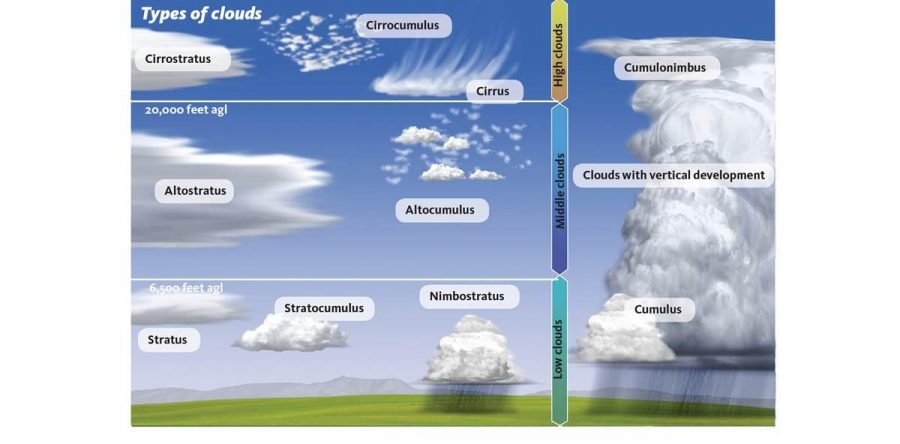
Classification of clouds
Meteorologists have classified clouds according to two criteria: their altitude and their form.
For the altitude, they have divided the troposphere into three layers: the lower layer from 0 to 2.000 meters, the middle layer from 2.000 to 7.000 meters and the upper layer from 7.000 to 11.000 meters.
We can identify which layer a cloud belongs to by its prefix: Cirrus for the upper layer, Alto for the middle layer and the absence of a prefix for the lower layer.
The second is the form: main cloud forms are distinguishable layered clouds which refer to using the word Stratus, and accumulated clouds; the Word cumulus and Cumulo being used for them.
Within the upper layer, we see Cirrus, cirrostratus and cirrocumulus clouds which are mainly composed of small ice crystals. Within the middle layer, we find clouds composed of water droplets called Alto-stratus or Auto-cumulus. Finally, we see stratocumulus and Stratus cloud at the lowest altitudes.
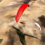
Since we paraglide at that altitude these are the clouds paragliding pilots usually pay attention to stratus clouds are the lowest they form fog or white blanket soft mist at the bottom of the valleys in the morning. Stratocumulus may at times cover the entire sky, they are generally grey. Then you have cumulus clouds which developed throughout the day due to thermal lift this is why they are a paraglider pilots favourite clouds.
Finally, there are clouds with impressive vertical development such as cumulus congestus nimbostratus or Cumulonimbus. These clouds belong to several levels at the same time Cumulus Congestus are cumulus clouds that have kept on developing vertically their bulging shape is typical at this point they become very dangerous clouds for paragliding. A nimbostratus cloud is very dark at its base and quite thick; it's a rain cloud with strong vertical development and more so because of its lack of visibility it is a dangerous cloud for free flight. Then there are Cumulonimbus clouds which can develop and extend as high as 12,000 meters; this cloud is by far the most powerful. You're better off admiring this type of cloud from the ground.
(From the video "Learn to Fly")